Cimarron National Grassland is a finalist because...of its early pioneering advancements in conservation, because it contains the longest publicly-owned section of the historic Santa Fe Trail, and because it features three ecosystems and has the only known outcrop of Jurassic-age rocks (150 million years old) in Kansas.
Location: 2 miles north of Elkhart on K-27. Always open. No fee.
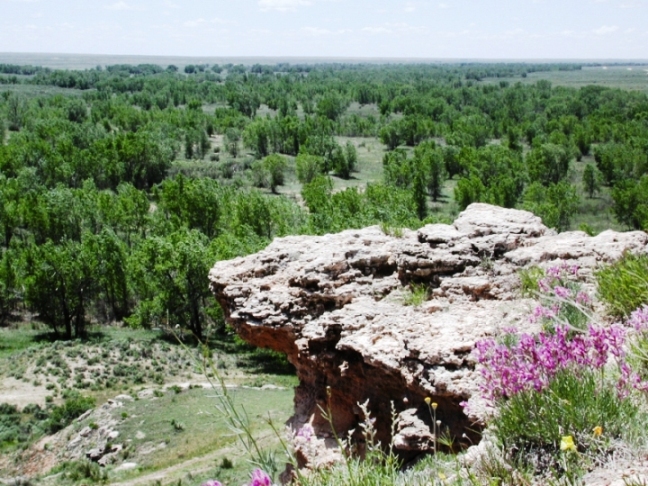
Courtesy of the U.S. Forest Service
THE THREE ECOSYSTEMS
The first ecosystem in the grassland is sandsage. It's made up of blowing sand dunes covered with sandsage brush and midgrass species. The second is the short grass prairie with shallow rocky bluffs going up to the flat prairie. The third is the riparian area where the mostly dry Cimarron River runs.
HOW THE GRASSLAND CAME TO BE Located in the southwest corner of Kansas, in Morton and Stevens counties, it is one of only 20 national grasslands in the United States and contains more than 100,000 acres. It is the largest tract of public land in Kansas. The Grassland offers an abundance of prairie flowers, wildlife, and excellent opportunities for bird-watching. The prairie chicken leks are famous here.
Following the most disastrous years of the infamous Dust Bowl of the 1930s, the federal government bought land and took it out of production in order to help control wind erosion that was ravaging the Great Plains. In 1954 it was designated a national grassland and assigned to the Forest Service. The Soil Conservation Service developed new methods to control erosion by establishing vegetation that would provide protection. The grassland is not a relic area of the original plains vegetation but includes land that was at one time held by private owners for agricultural purposes. SANTA FE TRAIL CONNECTION Twenty-three miles of the Santa Fe Trail cut across the grassland. Two of the best known landmarks along the entire Santa Fe Trail are located here. Point of Rocks is a flat-topped outcrop of light gray rock that overlooks the Cimarron River Valley. In fact, it is the third highest point in the state at the elevation of 3,540 feet. It was used as a lookout by both Native Americans and settlers. Middle Spring was one of the rare reliable sources of water in this area along the overland trail.
A 30-mile self-guided auto tour takes you along the Santa Fe National Historic Trail. See contact information below to obtain a brochure. If you don't want to follow the entire auto tour, take time to stop at the Santa Fe Trail sites of Middle Spring and Point of Rocks (turn west a half mile north of the Cimarron River bridge off K-27). Contact:
Cimarron National Grassland, sharilbutler@fs.fed.us. Get brochures at
Cimarron National Grassland office east of Elkhart on U.S. 56 at 242
Highway 56 East.