
Address:
Phone:
Website: www.ksbyways.org/Pages/Post/post1.html
 The
byway connects I-70 on the south with K-18 on the north and links the
communities of Wilson (Ellsworth County) and Lucas (Russell County).
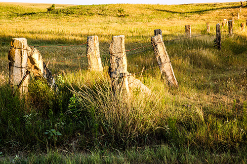
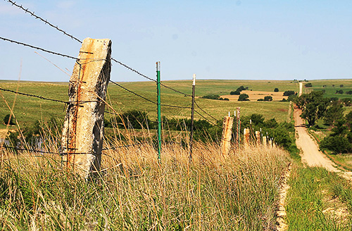
This byway is named for the unique native limestone rocks used for
fenceposts in the area.
The
byway connects I-70 on the south with K-18 on the north and links the
communities of Wilson (Ellsworth County) and Lucas (Russell County).
This byway is named for the unique native limestone rocks used for
fenceposts in the area.
The byway offers scenic, recreational, geological and agricultural viewing opportunities.
A six-mile segment of the byway is adjacent to the Wilson Lake recreational area with scenic turnouts that overlook the dam and offer vistas of the lake and the valley below the dam. Rest areas, trails, picnic areas and campgrounds offer a variety of recreational opportunities.
Wilson Lake covers 9,000 acres and holds various state fishing records. Weekend anglers and fishing tournament participants can seek white bass, walleye, striped, small mouth and large mouth bass.
Contact: lucascoc@wtciweb.com
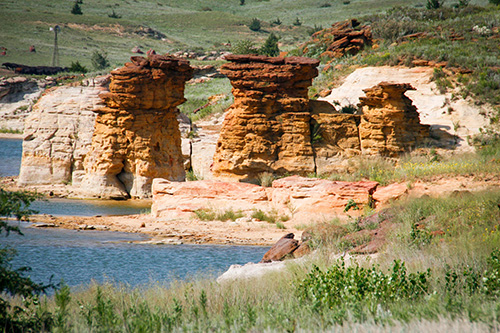 ROCKTOWN TRAIL (Wilson Reservoir trail): This 3-mile loop travels primarily through native prairie. The views of the Smoky Hills are spectacular. A deep canyon slices through a hill close to the lake and massive red sandstone formations rise out of the water.
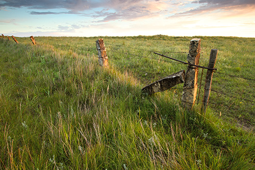 MORE ON THE DAKOTA FORMATIONS OF THIS AREA
During the Cretaceous Period (that interval of geologic time from about 144 to 66 million years ago), Kansas was once again under water. Unlike the relatively shallow seas of the Pennsylvanian and Permian, the seas that advanced and retreated during the Cretaceous were deeper and more widespread. Three principal rock outcrops characterize the Smoky Hills--the sandstones of the Dakota Formation, the limestone of the Greenhorn Limestone, and the thick chalks of the Niobrara Chalk.
 Many of the outcrops and roadcuts along K-232 are Dakota Formation
sandstone but some Greenhorn Limestone (just north of I-70), as well.
Many of the outcrops and roadcuts along K-232 are Dakota Formation
sandstone but some Greenhorn Limestone (just north of I-70), as well.
The Dakota Formation sandstones crop out in a wide belt from Rice
and McPherson counties, in the south, to Washington County, in the
north. They are the remains of beach sands and sediments dumped by
rivers draining into the early Cretaceous seas. The hills and buttes
in this part of the Smoky Hills, such as Coronado Heights in Saline
County, are capped by this sandstone and rise sharply above the
surrounding plains.
The third and westernmost range of hills in the Smoky Hills developed on the thick chalks of the Niobrara Chalk.